
Introduction
Contemporary discussions of the Indo-Mediterranean often present it as a novel geopolitical construct emerging from initiatives such as the India–Middle East–Europe Economic Corridor (IMEC). This paper argues instead that the Indo-Mediterranean is the re-emergence of an older civilisational and maritime geography, in which the Arabian Sea, Persian Gulf, Red Sea, and Mediterranean formed an interconnected commercial and cultural network, with India as one of its principal nodes.
This geography receded from Indian strategic thought not merely because trade routes changed, but through successive strategic and conceptual disruptions. Continental volatility redirected political attention towards land defence, while European naval powers displaced indigenous Bhāratīya control of its maritime space. Colonial cartography universalised territorial categories while marginalising native frameworks of connectivity, a manifestation of what Rajiv Malhotra calls Western Universalism. Partition and subsequent security pressures reinforced this orientation, recasting West Asia from an extended maritime neighbourhood into a region viewed primarily in terms of energy, diaspora and crisis management.
IMEC should therefore be situated within the reconstitution of an Indo-Mediterranean strategic continuum rather than understood only as infrastructure or great-power competition. Viewed through this lens, India is not merely a participant but a civilisational connector whose future role depends on shaping connectivity between the Indian Ocean, West Asia and Europe.
Our paper comprises three sections. The first examines ancient Indian Ocean maritime traditions using archaeological and textual evidence. The second discusses the decline of this maritime focus in India’s strategic thinking and its impact on the IMEC. Finally, we frame the Indo-Mediterranean strategic shift as a revival of India’s historical western horizon, aligned with current geostrategic realities.
Ancient Indian Ocean Region Maritime Networks: Maritime Orientation of Northwestern India
Lothal, in present-day Gujarat, exemplifies the Harappan cultural sphere’s maritime orientation and the active trade in the region during that period. The Archaeological Survey of India describes the site as “a Harappan port town” in its excavation report, reflecting its maritime centrality.[1] Lothal, Dholavira, Kuntasi, and other centres in Gujarat linked inland production zones to the Gulf of Kutch, the Makran coast in Iran, Oman, Bahrain, and southern Mesopotamia. Etched carnelian beads, produced using specialised South Asian techniques and recovered across the Persian Gulf and Mesopotamia, indicate organised, repeated exchange rather than chance contact.
Mesopotamian cuneiform texts from the Akkadian and Ur III periods distinguish Meluhha, Magan and Dilmun as distinct participants in Gulf trade, identifying Meluhha with the Indus Civilisation on the basis of textual, archaeological and material evidence.[2] Mesopotamian records refer to Meluhhan ships, merchants, and even an interpreter of the Meluhhan language, indicating direct commercial interaction rather than merely indirect exchange via intermediaries.[3] Evidence from the 3rd millennium BCE shows that Meluhhan ships reached Mesopotamian ports, and some Meluhhans lived in Sumer. Harappan seals found at Ur, Susa, Tell Asmar, and other Mesopotamian sites, together with Mesopotamian artefacts in Harappan settlements, highlight reciprocal exchange.[4]
Indigenous Navigational Knowledge
The traditional Western narrative that a Greek navigator named Hippalus “discovered” the monsoon is not a literal account of how navigation in the Arabian Sea began. Communities around the Indian Ocean had observed seasonal wind patterns long before Greek and Roman authors documented them. Indian, Arabian, and Gulf sailors were already navigating routes based on their understanding of seasonal winds, ocean currents, coastal landmarks, water sources, and optimal sailing conditions.[5]
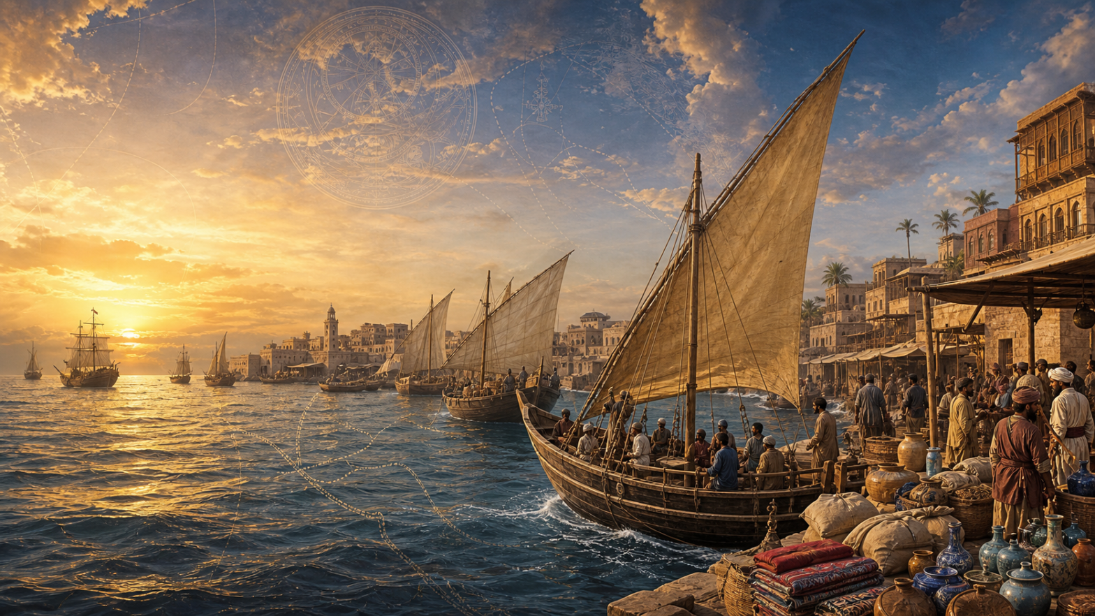
The Periplus of the Erythraean Sea reflects this established maritime knowledge and identifies Barygaza (Bharuch), linked to inland production centres via the Narmada, as a major port. Together with Barbarikon, Sopara, Kalyan, and ports along the Konkan and Malabar coasts, it formed a coastal network that gathered and redistributed goods before they passed through Arabia and Egypt..[6]
Indian Merchants at Socotra and Epigraphic Evidence in Egypt
The Hoq Cave inscriptions on the strategic island of Socotra in Yemen provide direct evidence of Indian travellers at the entrance to the Gulf of Aden. Predominantly written in Indian scripts, especially Brahmi, they record the names, origins, and affiliations of visitors who used the island as a stopover between western India, southern Arabia, the Horn of Africa, and the Red Sea. Tamil-Brahmi inscriptions from Quseir al-Qadim, the ancient Red Sea port of Myos Hormos, and Berenike likewise establish the presence of Tamil-speaking travellers in Roman Egypt, while inscriptions in the Valley of the Kings indicate movement beyond coastal trading settlements into the Nile-Red Sea corridor.[7],[8],[9] Findings from Bahrain, Oman, Mesopotamia, Failaka Island, and Berenike indicate that Red Sea ports were major contact zones linking South Asian trade to the Roman, Arab, and African worlds.[10],[11],[12]
The Muziris Papyrus also shows that commerce between southern India and Egypt was supported by credit, contracts, taxation, cargo assessment, and institutional enforcement. One side contains part of a loan agreement financing a commercial enterprise linked to southern India; the other records the fiscal valuation of a cargo imported aboard the vessel Hermapollon.[13] These transactions involved a range of stakeholders, including capital providers, shipowners, merchants, cargo agents, customs officials, warehouse operators, and purchasers.
The Indo-Mediterranean trade formed a network of institutions linking Indian production centres to coastal emporia, with sea routes connecting Arabia, Egypt, Alexandria, and Mediterranean markets. Indian merchants and sailors linked the Arabian Sea and the Red Sea, demonstrating that the Indian subcontinent played an active role in trade rather than merely serving as an endpoint of Mediterranean expansion.[14]
Indian perspectives
Ancient Indian textual traditions treated maritime activity not as peripheral or exceptional, but as an integral component of statecraft, commerce, and political geography. The Arthaśāstra assigns the Navādhyakṣa (Superintendent of Ships) responsibility for ships, ports, ferries, navigation, customs, and maritime trade, presenting the sea as a regulated economic space through which goods, merchants, and revenue moved under state supervision. The Arthaśāstra regards the western sea (apara samudra) as part of the state’s commercial geography. [15]
Sangam literature offers another important indigenous southern Indian perspective. Poems describe Yavana (Ionian) merchants arriving by sea, bringing gold and wine and purchasing pepper and other valuable commodities from ports such as Kaveripattanam (Puhar).[16] The Akanānūru and Puranānūru references to foreign gold mirror Pliny the Elder’s well-known complaints about Roman bullion flowing eastward. Although independent, the Tamil poems and Pliny together offer valuable evidence of the trade connections between southern India and the Roman world.[17] The Chera, Chola and Pandya polities are portrayed as maritime kingdoms whose prosperity and prestige depended in part on ports, merchant activity and overseas exchange. The Pattinappālai presents maritime exchange as a defining feature of urban life on the Tamil coast.[18], [19]
More broadly, Indian texts generally described the western world through peoples—Yavana-s, Pārasīka-s, Śaka-s, Bāhlika-s and Kamboja-s—rather than as a bounded “Mediterranean” region. The argument advanced here is not that premodern Indian sources possessed a concept equivalent to the modern term “Indo-Mediterranean.” Rather, “Indo-Mediterranean” is employed as a contemporary analytical category for a historically demonstrable geography of interaction that modern regional classifications subsequently divided into the Indian Ocean, West Asia and the Mediterranean. The cumulative evidence presents the Arabian Sea and its western extensions as a historically layered commercial continuum, linked by repeated voyages, resident merchant communities, transferable financial practices, intermediary ports and inland transport corridors. India was therefore not a passive endpoint of Mediterranean expansion but an active centre, with ports, merchants and producers helping to shape the wider western Indian Ocean economy. [20]
Why this Geography disappeared from India’s Strategic Consciousness
The Indo-Mediterranean region, despite its historical significance, became less prominent in India’s strategic outlook as political disruptions shifted focus from maritime to continental security. Over several centuries, recurrent pressures on the subcontinent’s northwestern approaches increasingly competed with maritime priorities for the attention of major political formations; European expansion subsequently transformed this imbalance by progressively transferring coercive control of the sea to European powers. The emergence of the modern territorial state further consolidated this transformation in three key stages.
The first major transformation began in the 11th century with successive waves of incursions by Turco-Afghan, Persian, and Central Asian forces. The Indo-Gangetic plain and the northwestern frontier became key arenas of political competition, prompting states to prioritise cavalry, fortifications, and continental empires over maritime commerce. While ports such as Cambay and Surat remained active, maritime influence in state strategy diminished.
European expansion brought significant changes in its second stage, as the Portuguese, Dutch and British sought to control commerce through naval power, fortified ports and monopolistic companies. While Indian merchants remained active, maritime security and political authority shifted to European powers, diminishing Indian strategic control over the western Indian Ocean, which remained a trading space.
The final stage of this process occurred during British colonial rule, which reinforced geopolitical realities through new intellectual frameworks. Colonial governance required viewing India as a territorial possession, thereby transforming both its understanding and its governance.[21] British cartography transformed India into a bounded territorial entity, emphasising measurable space over historical networks of interaction.[22] The governance framework increasingly emphasised provinces, districts, borders, and territorial sovereignty. Maritime spaces, once seen as connectors, became imperial boundaries. A Western Universalist shift occurred as European ideas about maritime trade, sovereignty, and authority were regarded as universally valid.
Independent India inherited this framework under severe pressure. Partition, the Kashmir issue, refugee rehabilitation, princely-state integration, the 1962 war with China, repeated wars with Pakistan, and ongoing border disputes made continental defence a rational priority. Indian strategic thought naturally prioritised territorial integrity, border management, and conventional military threats, as these posed the principal dangers to the state’s survival.
This historical experience also reveals a subtler consequence: political sovereignty does not automatically restore the native conceptual frameworks through which a civilisation understands itself. Genuine sovereignty extends beyond political independence to encompass the recovery of intellectual frameworks through which a civilisation interprets its history, geography and strategic priorities. These frameworks determine which spaces, relationships and problems appear strategically important; their persistence can therefore shape national priorities long after formal colonial rule has ended.[23]
Applied to India’s western maritime horizon, this perspective suggests that the gradual disappearance of the Indo-Mediterranean from strategic consciousness reflected not only changing geopolitical circumstances but also a shift in the conceptual language through which geography itself was understood. The Arabian Sea increasingly appeared as India’s western boundary, while West Asia was approached primarily through energy security, labour migration, expatriate welfare, and regional crises, rather than as an extended maritime neighbourhood. While these concerns remain strategically important, they represent a significantly different conception of India’s relationship with the region. West Asia came to be understood as an external geopolitical theatre rather than as part of an extended maritime neighbourhood historically connected to the subcontinent through dense networks of exchange.[24]
Understanding this historical trajectory is essential to interpreting contemporary developments, such as the India-Middle East-Europe Economic Corridor (IMEC). IMEC should not be seen as a new geopolitical region or as a response to contemporary great-power competition in the region, but rather as a revival of an older maritime geography whose strategic importance was overshadowed by history.
It requires recognising that India’s strategic geography has always been both territorial and civilisational, continental and maritime. The Indo-Mediterranean is best understood not as an invented geopolitical construct but as the contemporary reappearance of a much older civilisational space, whose historical coherence is once again becoming strategically visible.
The Return of the Indo-Mediterranean: From Spice Route to Smart Corridor
Recovering a Bhāratīya maritime perspective is not an exercise in nostalgia or in recreating antiquity, but in adapting enduring geographic realities to contemporary strategy. As the global economic centre of gravity shifts towards Asia, the Indian Ocean is once again becoming the connective space linking major centres of production, energy, and consumption. Maritime transport carries over 80% of global trade by volume, and vulnerabilities in the Suez Canal, the Red Sea, and the Strait of Hormuz highlight the Indo-Mediterranean region’s influence on global supply chains, energy flows, and industrial production.[25]
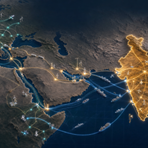
IMEC should be understood in light of this structural context. The 2023 Memorandum of Understanding explicitly envisages an eastern corridor linking India to the Arabian Gulf and a northern corridor linking the Gulf to Europe. Crucially, its proposed infrastructure extends beyond conventional cargo: alongside ports and railways, participants envisage electricity and digital connectivity cables, as well as infrastructure for the export of clean hydrogen.[26] IMEC is more than a transport route; it forms an economic geography that connects India, the Gulf and Europe across various strategic domains.
The older Indian Ocean networks transported high-value commodities such as pepper, textiles, and gemstones. In contrast, the emerging Indo-Mediterranean network is likely to encompass pharmaceuticals, electronics, digital services, clean energy, critical minerals, advanced manufacturing, and artificial intelligence-related technologies. Commodities and infrastructure change, but geography remains – the Spice Route becomes a Smart Corridor. The Arabian Sea, the Gulf, the Red Sea, and the Mediterranean serve as vital links for India to access European markets and connect Gulf production with European consumption.
This is particularly important in an international system that is becoming increasingly multipolar. External Affairs Minister S. Jaishankar has argued that “multipolarity is here to stay”, noting that no single country now possesses hegemonic capabilities across all domains and that different regions will increasingly contribute distinct forms of power and capability.[27] If this diagnosis is correct, multipolarity requires a corresponding physical architecture, not merely a description of power distribution. IMEC is a key element of the Indo-Mediterranean architecture that underpins a multipolar order, requiring multiple centres of production, finance and technology. Essential infrastructure, such as railways, ports, energy grids and digital networks, facilitates trade and communication while reducing reliance on any single external provider. Such infrastructure shapes how states access markets, technologies and information, potentially creating strategic dependence even while formal political sovereignty is maintained.
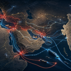
Global supply-chain disruptions highlight the risks of relying on limited transport routes. Disruptions in the Red Sea and at the Suez Canal have led to higher freight costs and longer shipping routes. In 2023, about 22% of global seaborne container trade passed through the Suez Canal, but subsequent security issues prompted significant rerouting around the Cape of Good Hope.[28] The Strait of Hormuz remains a critical maritime chokepoint, highlighting how energy vulnerabilities have shifted resilience and diversification from commercial efficiency to national strategy.
IMEC’s strategic value lies in the options it creates, enhancing rather than replacing existing maritime routes. The IMEC memorandum emphasises a proposed ship-to-rail network to strengthen regional supply chains alongside current routes.[29] Diversifying infrastructure enables states to handle disruptions more effectively, select alternative routes and partners, and reduce dependence on a single logistics system.
This directly aligns with India’s longstanding preference for strategic autonomy. In a multipolar world, strategic autonomy cannot rest solely on diplomatic freedom of manoeuvre; it increasingly requires infrastructural freedom of manoeuvre. A state whose critical supply chains, digital connectivity, energy flows or access to markets depend overwhelmingly on infrastructure controlled by others has less practical autonomy than its formal sovereignty might suggest. By participating in the creation of interoperable and diversified connectivity across the Indo-Mediterranean, India and its partners can expand their strategic options without requiring political alignment into rigid blocs.
Conclusion
The relevance of India’s civilisational memory lies precisely in its capacity to illuminate the future rather than to reproduce the past. We interpret this movement towards IMEC as part of a broader decolonising process and a recovery of India’s historical understanding of its western maritime geography. This recovery entails distinguishing between adopting the institutions of the modern international system and regarding the conceptual frameworks from which they originated as universally applicable. Malhotra’s critique of Western Universalism is valuable in this context, not primarily because it explains the historical Indo-Mediterranean—which stands firm on the textual, archaeological, and commercial evidence analysed in this paper—but because it offers a lens through which we can understand its subsequent conceptual marginalisation. Political decolonisation did not automatically lead to the revitalisation of indigenous frameworks that shaped India’s understanding of its own geography. Thus, reclaiming the Indo-Mediterranean is not about dismissing modern geopolitics; rather, it’s about expanding India’s strategic imagination beyond the categories derived from a specific European historical experience.
India’s strategic task is therefore not to reconstruct an ancient maritime order, but to recognise that an old geography has taken on new technological and geopolitical significance. IMEC offers a contemporary expression of that geography, but the broader opportunity lies in reclaiming India’s western maritime horizon as a coherent strategic space. In a multipolar order, India’s ability to act as a civilisational and geographic connector will depend not only on participating in corridors designed around it, but on developing the intellectual, diplomatic and material capacity to shape the architecture linking the Indian Ocean, West Asia, and Europe. The return of the Indo-Mediterranean is therefore not a return to the past, but the recovery of an old geography for a new strategic age.
Author Brief Bio:
- Manogna Sastry is Team Leader, Research, and Senior Research Fellow at Infinity Foundation. With an educational background and strong grounding in theoretical physics and mathematics, her research spans astrophysics, Indology, civilisational and consciousness studies, sustainability, and education. She brings scientific rigour to reinterpreting historical and civilisational paradigms from non-dominant perspectives.
- Subhodeep Mukhopadhyay is Senior Research Fellow at Infinity Foundation.
Endnotes
[1] S. R. Rao, Lothal: A Harappan Port Town, 1955–62, vol. 1, Memoirs of the Archaeological Survey of India 78 (New Delhi: Archaeological Survey of India, 1979); Ekta Gupta, V. N. Prabhakar, and Vikrant Jain, “Sabarmati and Its Connection with the Harappan Port Lothal and the Nal Corridor: A Study Using Multi-Sensor Data, Cloud-Computing and Multi-Platforms,” Journal of Archaeological Science 170 (2024): 106028.
[2] Gregory L. Possehl, The Indus Civilization: A Contemporary Perspective (Walnut Creek, CA: AltaMira Press, 2002), 215–23; Daniel T. Potts, The Arabian Gulf in Antiquity, vol. 1, From Prehistory to the Fall of the Achaemenid Empire(Oxford: Clarendon Press, 1990), 119–45.
[3] Potts, Arabian Gulf in Antiquity, 1:128–40; Asko Parpola, Deciphering the Indus Script (Cambridge: Cambridge University Press, 1994), 140–46.
[4] Possehl, Indus Civilization, 219–25; Jonathan Mark Kenoyer, Ancient Cities of the Indus Valley Civilization (Karachi: Oxford University Press, 1998), 96–103; S. Kalyanaraman, Indus Script: Meluhha Metalwork Hieroglyphs (Chennai: Sarasvati Research Center, 2014).
[5] K. N. Chaudhuri, Trade and Civilisation in the Indian Ocean: An Economic History from the Rise of Islam to 1750(Cambridge: Cambridge University Press, 1985); Himanshu Prabha Ray, The Archaeology of Seafaring in Ancient South Asia (Cambridge: Cambridge University Press, 2003); Periplus Maris Erythraei 44–49.
[6] Periplus Maris Erythraei 1–66, in Lionel Casson, trans. and comm., The Periplus Maris Erythraei: Text with Introduction, Translation, and Commentary (Princeton, NJ: Princeton University Press, 1989); Periplus 19–36, 39–60.
[7] Ingo Strauch, ed., Foreign Sailors on Socotra: The Inscriptions and Drawings from the Cave Hoq (Bremen: Hempen Verlag, 2012); Eivind Heldaas Seland, “Archaeology of Trade in the Western Indian Ocean, 300 BC–AD 700,” Journal of Archaeological Research 22, no. 4 (2014): 367–402. The majority of Indian inscriptions at Hoq Cave are written in Brahmi, indicating participation by travellers from multiple regions of the Indian subcontinent rather than a single locality.
[8] Roberta Tomber, Indo-Roman Trade: From Pots to Pepper (London: Duckworth, 2008); Iravatham Mahadevan, Early Tamil Epigraphy: From the Earliest Times to the Sixth Century A.D. (Cambridge, MA: Department of Sanskrit and Indian Studies, Harvard University, 2003); Donald S. Whitcomb and Janet H. Johnson, eds., Quseir al-Qadim 1980: Preliminary Report (Malibu, CA: Undena Publications, 1982).
[9] Steven E. Sidebotham, Berenike and the Ancient Maritime Spice Route (Berkeley: University of California Press, 2011); Strabo, Geography 17.1.13.
[10] Jonathan Mark Kenoyer, Ancient Cities of the Indus Valley Civilization (Karachi: Oxford University Press, 1998), 152–60; Massimo Vidale, “Growing in a Foreign World: For a History of the ‘Meluhha Villages’ in Mesopotamia in the 3rd Millennium BC,” in Melammu Symposia IV: Proceedings of the Fourth Annual Symposium of the Assyrian and Babylonian Intellectual Heritage Project, ed. A. Panaino and A. Piras (Milan: Università di Bologna and IsIao, 2004), 261–80.
[11] Sidebotham, Berenike and the Ancient Maritime Spice Route, 189–94; René T. J. Cappers, Roman Foodprints at Berenike: Archaeobotanical Evidence of Subsistence and Trade in the Eastern Desert of Egypt (Los Angeles: Cotsen Institute of Archaeology, University of California, Los Angeles, 2006); Seland, “Archaeology of Trade,” 367–402.
[12] Eivind Seland, “Archaeology of Trade,” 367–402 Journal of Archaeological Research (2014); Jeremy A. Simmons, “Behind Gold for Pepper: The Players and the Game of Indo-Mediterranean Trade,” Journal of Global History 18, no. 2 (2023): 276–99..
[13] Federico De Romanis, The Indo-Roman Pepper Trade and the Muziris Papyrus (Oxford: Oxford University Press, 2020); Grant Parker, The Making of Roman India (Cambridge: Cambridge University Press, 2008); P. J. Cherian, ed., Pattanam Excavations (Thiruvananthapuram: Kerala Council for Historical Research), relevant excavation reports.
[14] Eivind Heldaas Seland, “Networks and Social Cohesion in Ancient Indian Ocean Trade: Geography, Ethnicity, Religion,” Journal of Global History 8, no. 3 (2013): 373–90; Simmons, “Behind Gold for Pepper,” 276–99.
[15] Kauṭilya, Arthaśāstra 2.21, 2.28–29; R. P. Kangle, The Kauṭilīya Arthaśāstra, 3 vols. (Bombay: University of Bombay, 1960–65); Patrick Olivelle, trans., King, Governance, and Law in Ancient India: Kautilya’s Arthashastra (New York: Oxford University Press, 2013); Ray, Archaeology of Seafaring.
[16] Pattinappālai; K. A. Nilakanta Sastri, A History of South India: From Prehistoric Times to the Fall of Vijayanagar, 4th ed. (New Delhi: Oxford University Press, 1975); George L. Hart III, The Poems of Ancient Tamil: Their Milieu and Their Sanskrit Counterparts (Berkeley: University of California Press, 1975); R. Champakalakshmi, Trade, Ideology and Urbanization: South India 300 BC to AD 1300 (Delhi: Oxford University Press, 1996).
[17] Akanānūru; Puranānūru; Pliny the Elder, Natural History 12.84; Sastri, History of South India; R. Gurukkal, Rethinking Classical Indo-Roman Trade: Political Economy of Eastern Mediterranean Exchange Relations (New Delhi: Oxford University Press, 2016).
[18] M. Shanmugam Pillai, trans., Maduraikkāñci, in The Ten Tamil Idylls (Pattuppāṭṭu) (Thanjavur: Tamil University, 1995); Vimala Begley, ed., The Ancient Port of Arikamedu: New Excavations and Researches 1989–1992, 2 vols. (Pondicherry: École Française d’Extrême-Orient, 1996).
[19] Hart, Poems of Ancient Tamil; Gurukkal, Rethinking Classical Indo-Roman Trade; Pattinappālai; Akanānūru; Puranānūru.
[20] Himanshu Prabha Ray, The Archaeology of Seafaring in Ancient South Asia; R. Champakalakshmi, Trade, Ideology and Urbanization.
[21] Bernard S. Cohn, Colonialism and Its Forms of Knowledge: The British in India (Princeton, NJ: Princeton University Press, 1996).
[22] Matthew H. Edney, Mapping an Empire: The Geographical Construction of British India, 1765–1843 (Chicago: University of Chicago Press, 1997).
[23] Manogna Sastry, remarks in “Who Shapes India’s Self-Understanding?,” panel discussion, Indraprastha Cultural Festival, New Delhi, August 5, 2026, video, Infinity Foundation.
[24] David M. Malone, C. Raja Mohan, and Srinath Raghavan, eds., The Oxford Handbook of Indian Foreign Policy (Oxford: Oxford University Press, 2015); Shivshankar Menon, Choices: Inside the Making of India’s Foreign Policy (Washington, DC: Brookings Institution Press, 2016).
[25] United Nations Conference on Trade and Development, Review of Maritime Transport 2025 (Geneva: United Nations, 2025).
[26] Government of India, Kingdom of Saudi Arabia, United Arab Emirates, European Union, French Republic, Federal Republic of Germany, Italian Republic, and United States of America, “Memorandum of Understanding on the Principles of an India–Middle East–Europe Economic Corridor,” September 9, 2023.
[27] S. Jaishankar, remarks at the Raisina Dialogue, New Delhi, March 6, 2026.
[28] United Nations Conference on Trade and Development, Navigating Troubled Waters: Impact to Global Trade of Disruption of Shipping Routes in the Red Sea, Black Sea and Panama Canal (Geneva: United Nations, 2024).
[29] Government of India et al., “Memorandum of Understanding on the Principles of an India–Middle East–Europe Economic Corridor.”